


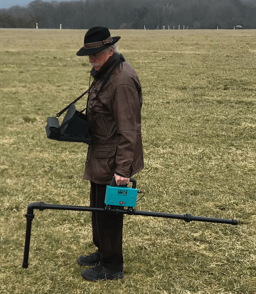
Measurement Methods

Extension with GPS receiver
Previously, the measurement had to be made in a fixed grid in order to obtain a geographic assignment. In the new version, random measurement points now are possible, whose positions are stored as GPS coordinates. An additional GPS receiver is used.


or the terrain is difficult to walk,
should be a manual measuring point recording
be performed.

XZ measuring method:
-The Hx/Hz measurement method is used in professional position and depth determination.
Selectable scope of delivery
1. Basic Set
Hardware:
- Receiver UG12
- Tablet 12 Inch with
detachable keypad
- Mounting rod for one antenna
- Antenna No.1
- Carrier bag 1 for hardware Basic Set
Software EMUNI package:
- Measurement software
„Profile- ESD“
- Frequency Search with
„Spectrum“
- Evaluationsoftware „2D/3D“
- „Setup“,
- „Connect“
2. Enhancements
Hardware for Measurements A-B, B-A and XZ-Depth determination
- Mounting rod for two Antennas
- Antenna No. 2
- Carrier bag 2 for hardware
Enhancements and Transmitter
Software packages:
- Measurement software
„Profile- EXZ“ (depth
determination)
- Tools, Calibration
software
GPS Measurement Software and Hardware
- Scan GPS
- Path
- Map
- Assign
Evaluation software for depth determination
- „HzEMSoft“ from EMTOMO LDA
This software is already installed with the EMUNI package. However, the unlock code must be requested from EMTOMO LDA.
3. Transmitter
- TRX 2 with 6 frequencies
19, 24, 33, 70, 90, 124 kHz
the frequencies can be
changed on request
- TRX 2 cable antenna
- Fits in carrier bag 2

Carrier Bag for the Basic Set

Carrier Bag for the Enhancements and Transmitter
EMFAD - TRX2 Transmitter
If the reception of existing (external) longwave transmitters is poor, the own transmitter (TRX2) is used. It can also be used to perform measurements with frequencies for which no long-wave transmitters exist or do not provide sufficient field strength.
Front panel:
On the front panel are the controls for frequency change, output power in percent, on/off switch and a display showing the respective status.
In measurement areas where no or only weakly incident transmitters can be determined, the dedicated TRX2 transmitter/generator is used. Six frequencies (19, 24, 33, 70, 90 and 124 kHz) can be generated with the transmitter. The transmitting frequency is coupled via a 40m wire antenna, which is laid out as round as possible on the ground.

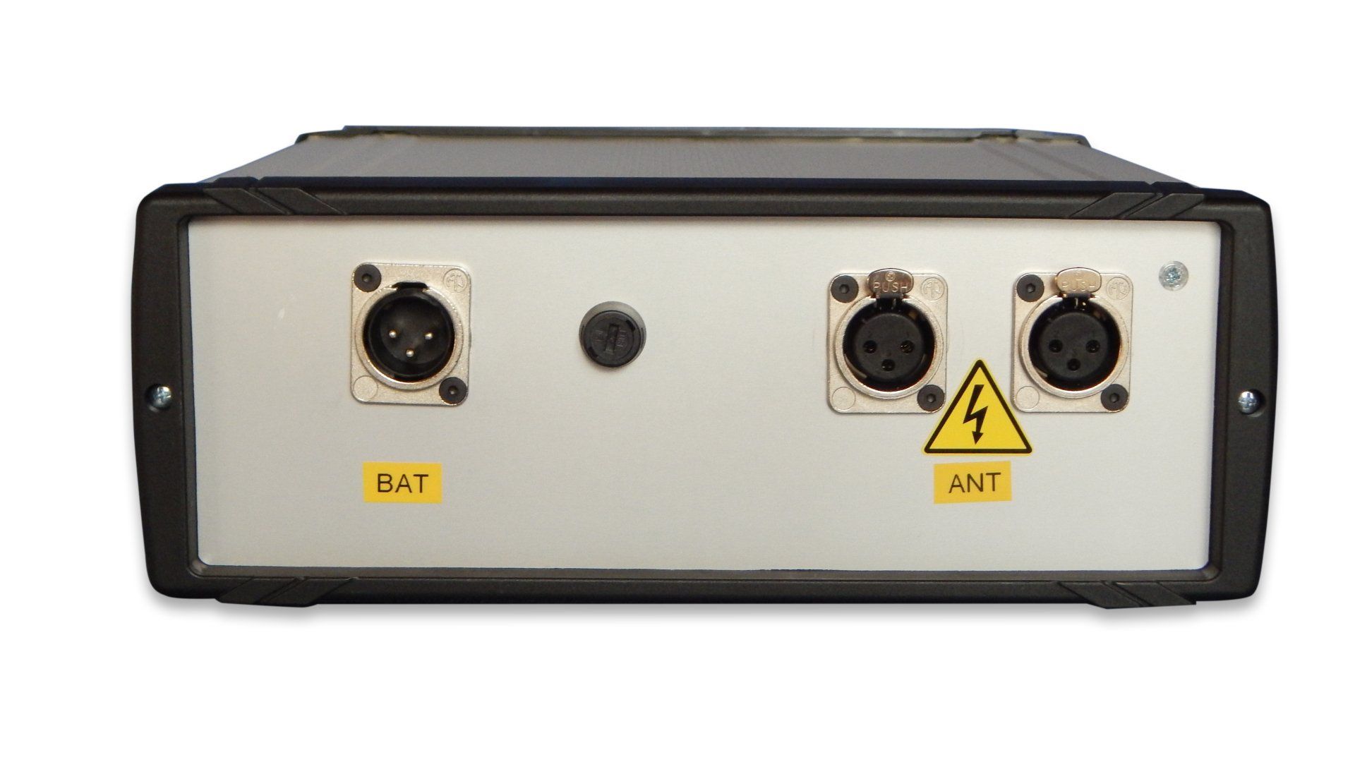
Rear panel:
At the rear are the outputs for the wire antenna, the charging socket for the lead/gel battery and a microfuse.
EMFAD®- EMUNI:
Recording and evaluation software


GPS - measurement
EMFAD-UG12 GPS builds on the proven EMFAD-UG12 and facilitates the measurement of large areas in particular due to its GPS receiver. With the GPS coordinates, the measurement no longer needs to be carried out in a fixed grid, but can be carried out at random points. In addition, measurement paths can be subsequently displayed on maps.
During the running measurement with "scanGPS" the following data are displayed for each measuring point:
- GPS, LAT, LON
- Available and used transmitter
- Position of the measuring points and signal strength


In the display "path" various evaluations can be made, e.g:
- in "set point" the position of the anomalies in
meters from the start point of the measurement in X/Y direction
or
distance in meters and degree number
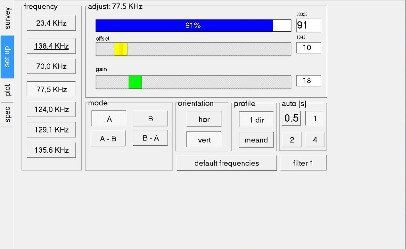
- in "mode select" all stored frequencies can bedisplayed
With "map" the GPS measurement can be transferred to a map

Profile raster measurement
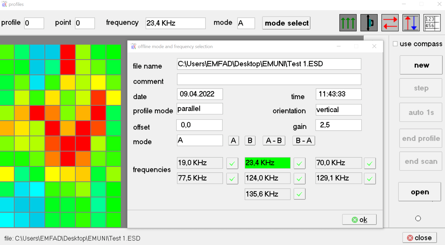
The picture shows a measurement performed with "profile ESD" with all additionally displayed settings from the "Setup".
Picture shows the beginning of a profile EXZ measurement, which is used as a basis for a depth determination. For this measurement, the horizontal alignment of the X antenna must always point to the transmitter. As soon as this is the case, a green point appears in the compass rose. The measurement point is then saved with Step.


Position and depth determination
The program HzEMSoft from EMTOMO LDL is part of the software package EMFAD-EMUNI and is used for professional depth determination.


The picture shows the measurement result of a profile EXZ measurement above a gas tube. Wherever the Hz-component of the electromagnetic field has a minimum, the Hx-component shows a maximum. This can be seen very well in this measurement example. The profile EXZ measurement is the data basis for a depth and position determination with HzEMSoft.
Figure shows the result of a depth and position determination of the pipe (distance Xo = 5.8m from the starting point of the measurement and the depth = 2.0m).
